RUFFIN IT WITH A SEIKO PERPETUAL
It's time for the sun to come up, and I'm in the living room with a cup of tea. Wearing a Seiko that I am very relieved to report has been rescued from my watchmaker's trash bin. But more on that later. The cat is howling - "Get out of here, you will be late!"

There's no rush today, as we are going to explore Ruffin Canyon. It might be a strenuous walk, and we need light to tackle the trail.

We took the slow road rather than the freeway this morning. It wasn't exactly sunrise, but stil a nice sky greeted us to the east.

It had been clear at our house, but inland there was a bank of fog spilling down over University Heights down into Mission Valley. I saw a very unusual lighting effect -- luckily the camera could capture it too. Light is actually casting shadows onto the fog.

Ruffin Canyon Open Space is just a couple miles west of Stonecrest, where we walked yesterday. Stonecrest is a paved path, Ruffin is a treacherous trail.
Ruffin Canyon Open Space is just a couple miles west of Stonecrest, where we walked yesterday. Stonecrest is a paved path, Ruffin is a treacherous trail.
I know I have some regular readers, and I would like to narrate today as if you are walking alongside us (or in single file) down this Ruffin trail.

Our first sight of wildlife wasn't scary; it was a cute little bird having a bath. However, she didn't seem too happy about being watched... so we moved on.

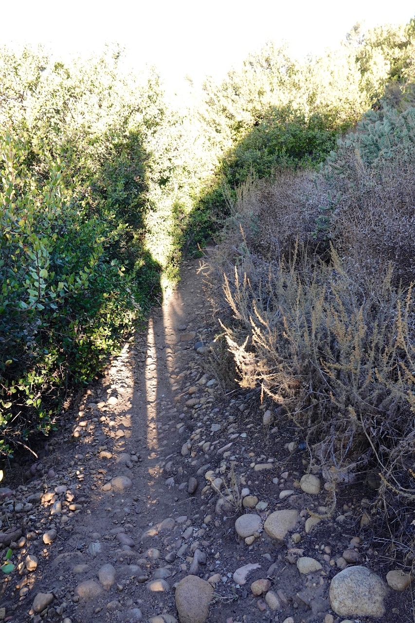
We intended to use this heavily-traveled, easy-to-walk and very civilized pathway. But about 100 yards later it fizzled out and became more difficult.

I am a veteran of such trails, having lived most of my lfe in this canyon-strewn city. Everywhere you (don't) look there is an enemy waiting to snag you.
We descended some stone steps, conveniently and no doubt laboriously fabricated by hikers.

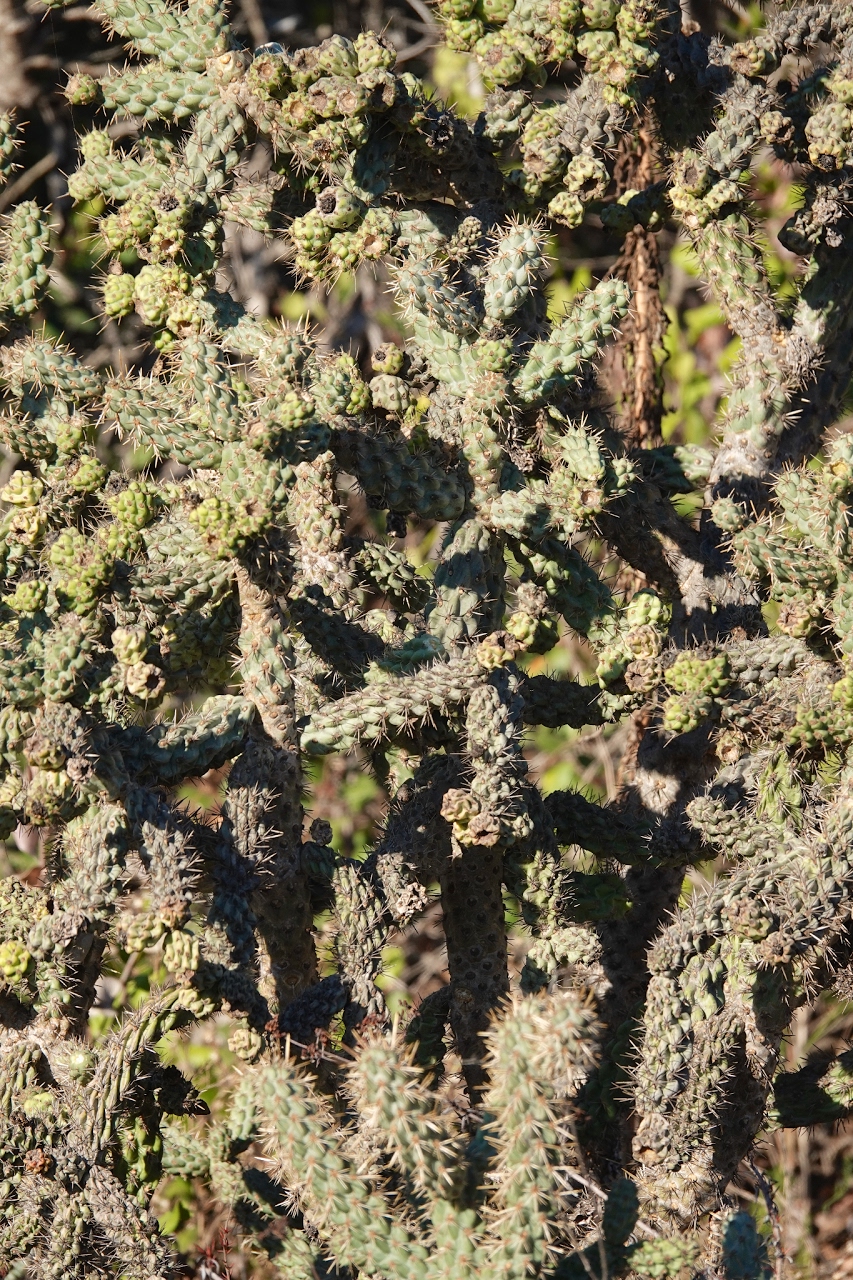
When you look up to follow the flock of screaming parrots, stop walking ...

so you don't land in the cactus thorns. If it's not cactus, then it's rolling rocks or rattling snakes.

Sample shown below:

We go downhill for awhile, then back up another set of steps, made of wood this time.

Then over a rise, across a ridge, and down the other side with the rising sun at our backs.
Suddenly it gets much colder, darker and steeper. Sweater on, sunglasses off.

This part of the trail actually goes through the bushes. Various limbs have been trimmed, archways constructed, and most hazards removed. But not all of them.
The bad news is because I was wearing a hat, I didn't notice a large branch, and nearly knocked myself out. The good news is my Grand Seiko hat saved me from getting my scalp badly cut.

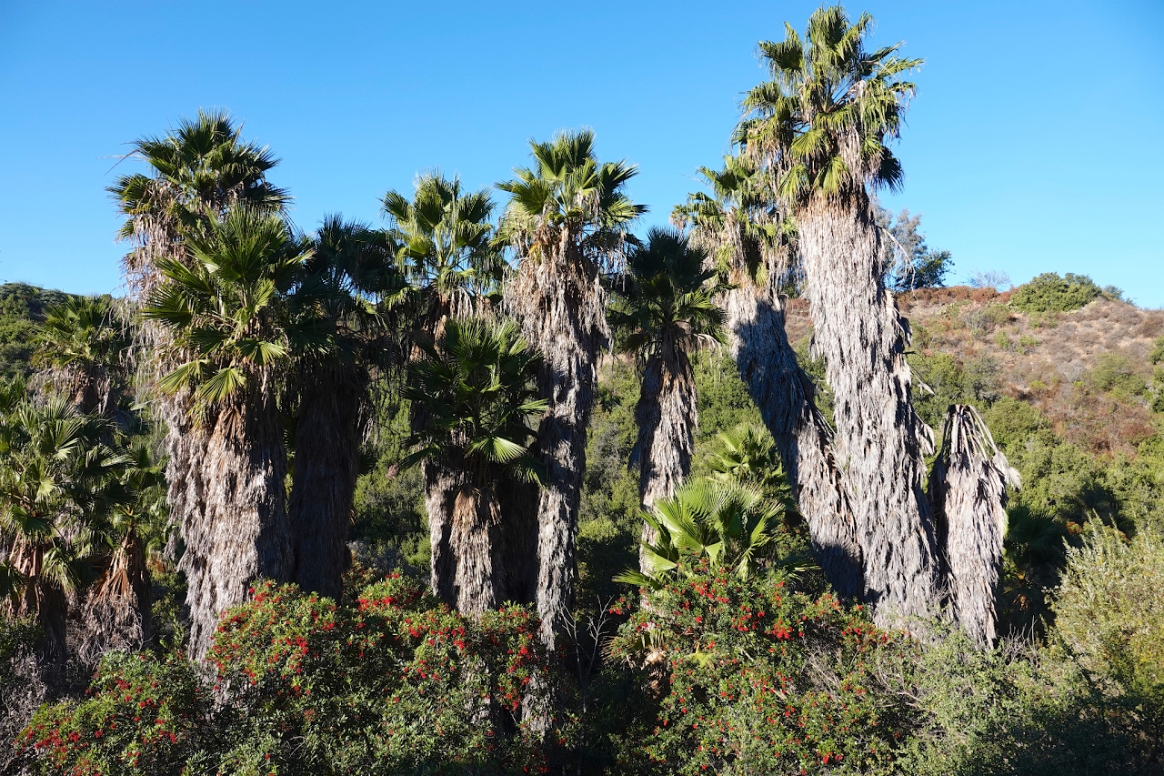
We made it to the bottom and a cluster of native Washingtonia Palms (as described yesterday).
This bush bursting with tiny flowers looked almost like a it was covered with snow.

The trail winds through the canyon bottom, through some Toyon bushes. We grabbed a few berries. After I research how to prepare them I will report back on our success or failure.

This stream was running slowly, and shallow enough not to deter our crossing.

It's beautiful country, and pleasant sights abound. Look around, but keep one eye on the trail. Our friends Jim and Cathy are Search & Rescue leaders for San Diego Sheriff's Department. Sadly a large number of the searches they conduct bring the lost hiker back on a stretcher, or in a body bag.

Here my new "Sketcher 65086 Relaxed Fit, Air Cool, Memory Foam" shoes fall woefully short of protecting my feet and ankles. It would be very easy to twist an ankle, and very hard to get back out if I did. It is always better to hike with a buddy around here. At least today we have cell reception, which is not the case in much of San Diego County.

If we go all the way to the bottom of the canyon there's no easy way out -- it ends above a gated community. Besides, our truck is at the top.

We'll struggle over the rocks a bit more after finally turning around. I'm so happy my watch is working properly. It's been my companion on many flights around the world.

"What's a flight?" you might ask, probably unable to name the last one you were on. I can't remember my last flight but I do remember I've flown 3 million miles on American Airlines alone... and only a few hundred miles in planes like this one.

So we head back, shedding our coats as we climb up about 350 feet in elevation.

Merry Christmas from our decorated Toyon Tree.

More rocks. Watch your step, and watch your head.

I've never seen these fluffy whorls before.

Guess what I am going to say about this stretch: _______________

So that's the top, eastern half of Ruffin Canyon. We didn't investigate the western branch.

We're almost back to the top and we look around for a moment, admiring some Bladderpod, with tiny yellow flowers and dangling seed pods.

The truck looks mighty good right now, sitting there across the parking lot, with water, comfy seats and another pair of shoes.

Taft Middle School looks a lot more like a prison than a school. They're all that way now. No wonder some of our young people can be shocked when they emerge to face the "outside world".

Time to rest for a moment and take off excess clothing.

So that's the top, eastern half of Ruffin Canyon. We didn't investigate the western branch.
We're almost back to the top and we look around for a moment, admiring some Bladderpod, with tiny yellow flowers and dangling seed pods.
The truck looks mighty good right now, sitting there across the parking lot, with water, comfy seats and another pair of shoes.
Taft Middle School looks a lot more like a prison than a school. They're all that way now. No wonder some of our young people can be shocked when they emerge to face the "outside world".
Time to rest for a moment and take off excess clothing.
As we drive home we run into the "marine layer" which has snuck in from the ocean. No matter, we're through for the day.

Thanks for reading, encouraging us, and wearing a Seiko!
Cazalea
Comments
Post a Comment